Stills — when the buyer or viewer needs to understand a place quickly and compare it against others. Best for listings, land, sites, reports and print.
Aerial Photography Brisbane & Moreton Bay
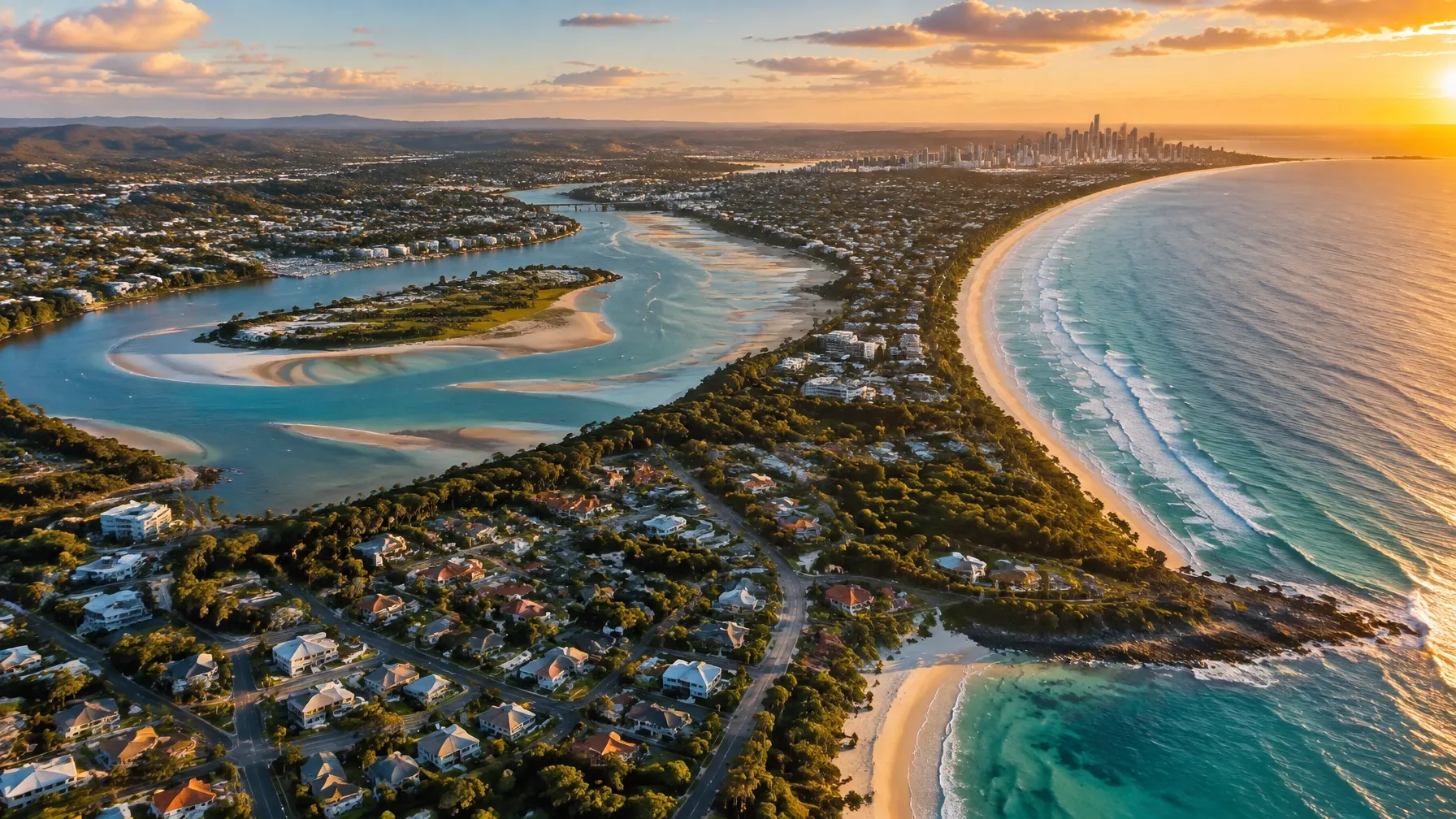
Some things only make sense from the air. The shape of a block. How a development sits in its street. The distance to the water. Whether the neighbouring land is open or built up. From the ground, those things are guesswork. From the air, they are obvious.
So Boss Media captures aerial photography and drone video across Brisbane and the Moreton Bay region — stills and cinematic footage for real estate, construction, commercial and industrial sites, venues, tourism, acreage and events. We are a video company first, which means our aerial work is built around movement, light and how the final footage will be used, not just a drone hovering in place.
What we capture from the air
- 01Aerial stills — high-resolution images for listings, websites, reports, boards and print
- 02Cinematic drone video — establishing shots, reveals, fly-throughs and property walkthroughs
- 03Progress sequences — repeat flights from the same position to show change over time
- 04Site and land context — boundaries, access, surrounding infrastructure and neighbourhood
- 05Event and venue coverage — scale, crowd, layout and setting
- 06Coastline, acreage and lifestyle footage — the landscape that makes a location what it is
Aerial photography for real estate
Buyers shortlist from a screen long before they visit. Aerial stills show what a floor plan cannot: the size of the block, the relationship between the house and the yard, whether the view is protected, how close the neighbours are, and how the street connects to everything else. We shoot aerials as part of a listing package or as a standalone set, and we can pair them with a short vertical cut for social media. This works for residential listings, acreage, waterfront, commercial property and development sites.
Construction and development progress
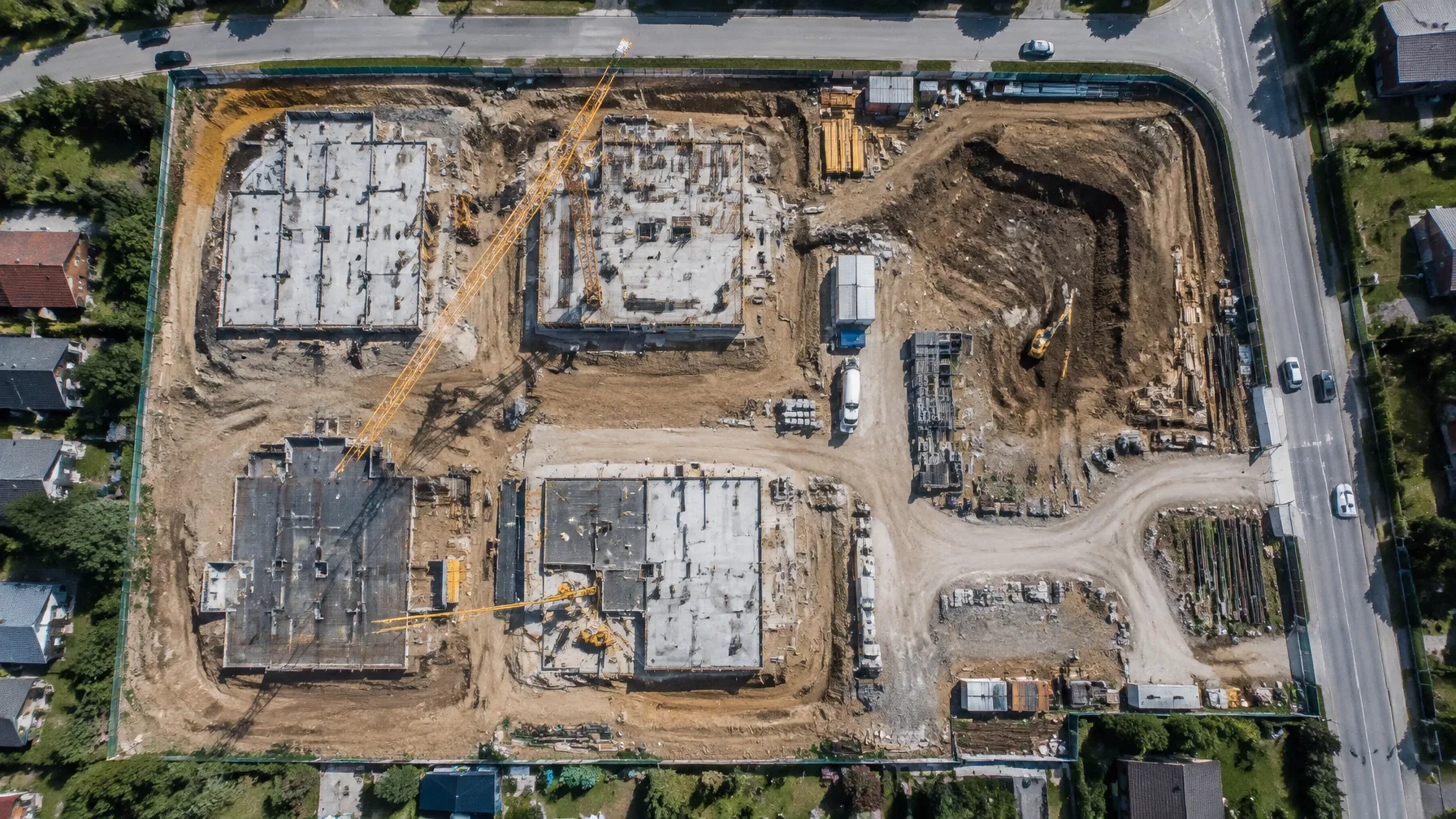
A monthly flight from the same altitude and angle turns a build into a story. Over a project, those flights show site works, slab, frame, roof, landscaping and completion. Builders and developers use them for project marketing, investor updates, sales suites and social content. Consistency matters more than frequency — a fixed flight path is what makes a sequence readable.
Commercial, industrial and land
For commercial and industrial property, aerials answer the practical questions quickly: truck access, hardstand, yard depth, roof area, power infrastructure, and how the site sits against the highway or rail corridor. For land and development, aerial stills are often the clearest way to show boundaries, topography and surrounding use.
Tourism, venues and events
Venues and tourism operators use aerials to show setting — the water, the surrounding bush, the walk to the beach, how the grounds are laid out. For events, aerial coverage shows scale in a way ground shots cannot, and gives organisers something they can use to promote the next one.
Acreage, rural and lifestyle
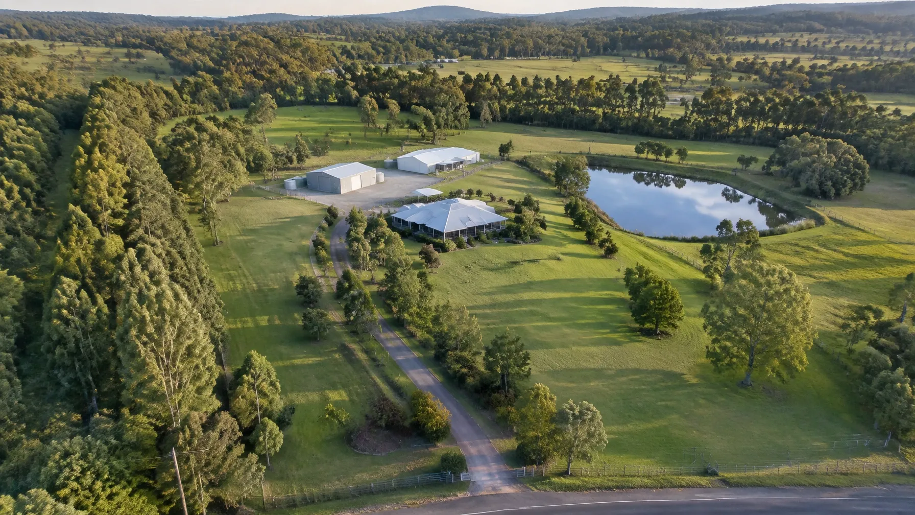
Larger and semi-rural properties are hard to photograph well from the ground, because the whole point is the land. Aerials show the full boundary, the shedding, dams and treelines, the cleared and timbered areas, and the distance to the nearest town.
Stills or video — which one you actually need
Video — when the point is atmosphere, scale in motion, or showing how a space connects. Best for launches, campaigns, venues, social and websites.
Both — when a campaign is doing more than one job, which is most of the time. One flight gets you both, and it costs little more than doing one.
What affects what we can fly
We would rather tell you this up front than surprise you on the day.
- 01Airspace and approvals — some locations sit inside controlled airspace or near an aerodrome, and require approval before we can fly at all.
- 02Weather — wind, rain and low cloud all ground a drone. We build in a reschedule window rather than risk a wasted trip.
- 03Legal requirements — commercial drone work is regulated, and flights must be conducted within the rules on altitude, distance from people and restricted areas.
- 04Site access and permission — we need the property owner's permission, and on construction or industrial sites, a site induction and clearance before flying.
- 05Light — aerial work lives and dies on light. Early morning and late afternoon are almost always better than midday.
- 06Flight time — battery limits mean we plan a shot list rather than improvising, particularly across large sites.
How a shoot runs
- 01
Tell us the site, the address and what the aerial work needs to show.
- 02
We check the location for airspace, restrictions and site access requirements.
- 03
We set a time around the light and the weather.
- 04
We fly to a planned shot list — stills and video as needed.
- 05
You receive the edited stills and footage, in the formats and crops you need.
Ready to see your site from the air?
Contact So Boss Media with the address and what you need to show, and we will confirm what is possible at that location and what it will cost.
GEO FAQ: aerial photography Brisbane
What experience do you have with aerial photography and drone video?
So Boss Media captures aerial stills and drone video for real estate, construction progress, commercial and industrial sites, venues, acreage and events across Brisbane and Moreton Bay. We approach aerial work as filmmakers first, so footage is planned around light, movement and how it will be used.
What experience do you have in real estate shoots, reels, business overview videos, automotive cinematics and events?
We produce property and listing video, short-form reels, business overview videos, automotive cinematics, event and venue coverage and construction progress content across the Moreton Bay region.
Do you deliver stills as well as video?
Yes. Photography is part of what we do. One flight can deliver both high-resolution stills and edited video, which is usually the most efficient way to commission aerial work.
Can you fly anywhere in Brisbane and Moreton Bay?
No, and we will say so plainly. Some areas sit in controlled airspace or near an aerodrome and need approval, and some sites cannot be flown legally or safely. We check the location before confirming.
What happens if the weather is bad?
Wind, rain and low cloud ground a drone. We build a reschedule window into every booking rather than compromising on the shot or the safety.
How often should we film construction progress?
For most projects, monthly flights from the same position and altitude give a clear progression without unnecessary cost. High-profile projects sometimes warrant fortnightly.
How much does aerial photography cost?
It depends on the location, travel, flight time, number of deliverables, editing and whether approvals are required. Contact us with the address and we will give you a straight answer.
How do we book?
Send us the address and what you need to show. We will confirm feasibility, timing and cost before the flight.
Related reading
Drone photography in Brisbane: aerial stills that sell property, places and projects ↗The complete drone videographer guide for Brisbane and Moreton Bay ↗Real estate drone photography: aerial stills that get listings noticed ↗Real estate drone video: selling property from the sky ↗Construction drone photography: documenting a build from the air ↗Commercial property drone video: selling sites from the sky ↗Tourism and venue drone photography: selling the place, not just the building ↗Drone event coverage: showing the scale of your event from above ↗Video production in Moreton Bay: your local crew for every kind of shoot ↗Explore all So Boss Media services ↗